
N°1 - La découverte des village au fil du Doron

mumu.larandonneuse
User GUIDE

Length
9.4 km

Max alt
1754 m

Uphill gradient
163 m

Km-Effort
12.4 km

Min alt
1421 m

Downhill gradient
404 m
Boucle
No
Creation date :
2023-03-16 08:49:31.269
Updated on :
2023-03-16 17:30:35.808
1h54
Difficulty : Easy

FREE GPS app for hiking
About
Trail Walking of 9.4 km to be discovered at Auvergne-Rhône-Alpes, Savoy, Les Belleville. This trail is proposed by mumu.larandonneuse.
Description
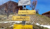
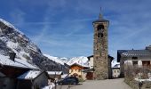
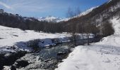
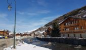
La rando "Découverte des villages au fil du Doron" des Menuires (1850 m) à Saint-Martin-de-Belleville (1450 m) passant par Le Bettex, Praranger et Saint-Marcel.
Départ au pied du télébenne de La Croisette.
Arrivée télécabine St Martin 1
Positioning
Country:
France
Region :
Auvergne-Rhône-Alpes
Department/Province :
Savoy
Municipality :
Les Belleville
Location:
Saint-Martin-de-Belleville
Start:(Dec)
Start:(UTM)
306971 ; 5021359 (32T) N.
Comments
Trails nearby
FR - VAL THORENS - Circuit des lacs de Val-Thorens


Walking
Very easy
(1)
Les Belleville,
Auvergne-Rhône-Alpes,
Savoy,
France

6.2 km | 8.6 km-effort
4h 15min
Yes
FR - VAL THORENS - Lac du Montaulever


Walking
Very easy
(2)
Les Belleville,
Auvergne-Rhône-Alpes,
Savoy,
France

4.5 km | 8.3 km-effort
2h 9min
Yes
le lou-la masse-les lacs


Walking
Very difficult
(1)
Les Belleville,
Auvergne-Rhône-Alpes,
Savoy,
France

23 km | 43 km-effort
7h 2min
No
Le sentier des Choumes ( N °9)


Walking
Easy
Les Belleville,
Auvergne-Rhône-Alpes,
Savoy,
France

6.7 km | 8.8 km-effort
1h 36min
No
Le sentier Giraud - N° 8


Walking
Easy
Les Belleville,
Auvergne-Rhône-Alpes,
Savoy,
France

5 km | 6.5 km-effort
1h 9min
No
La Croisette - Le Plan d'eau des Bruyères


Walking
Easy
Les Belleville,
Auvergne-Rhône-Alpes,
Savoy,
France

7.7 km | 10.5 km-effort
1h 53min
Yes
Lac du Lou


Walking
Medium
Les Belleville,
Auvergne-Rhône-Alpes,
Savoy,
France

11.3 km | 15.5 km-effort
4h 38min
Yes

descente point de la masse


Walking
Medium
(1)
Les Belleville,
Auvergne-Rhône-Alpes,
Savoy,
France

9.3 km | 13.3 km-effort
3h 30min
No

Le Lac du Lou


Walking
Medium
(2)
Les Belleville,
Auvergne-Rhône-Alpes,
Savoy,
France

7.4 km | 12 km-effort
3h 0min
Yes


 SityTrail


